Showing posts with label Utah. Show all posts

Tuesday, October 27, 2020

Bison Bison Bison

About two and a half years ago, we visited Theodore Roosevelt National Park in North Dakota. We wanted to visit a new state and see bison. We were successful in both efforts, although I think we never saw more than five bison together on that long weekend trip and we probably saw fewer than 50 bison total the entire time we were there. 

I called the post that I wrote about that trip Bison Bison, the animals' genus and species name, to emphasize that these creatures are not buffalo. Today's post adds another "bison" to the title because we just finished a trip where we saw way, way, way more bison than we did in 2018 in North Dakota. 

When I wrote my last bison blog post, I offered up some pretty chilling numbers: an estimated 20 to 30 million bison on the great plains before the arrival of European man reduced to 1,091 by the year 1889. Those statistics only considered bison on the great plains because that's where the slightly more than a thousand ended up. The real numbers are way worse. There are estimates out there of 30 to 60 million total bison alive before the 1800s, so it's really 60 million to 1,000 in less than a couple of centuries. It's an almost inconceivable destruction of a single species.

How did this happen? Hunting, habitat destruction, disease, the railroad, sport killing, a belief that slaying the bison would hasten the death of the Native American tribes. Take your pick. They are all significant factors. What is it about man that we feel compelled to wipe out every member of a species? Bison ranged as far east as Ohio at one point. Ohio!!!! I always think of bison as a western animal. Who'd have thought they lived that far east? Not me, certainly, but maybe that's because that's because they were wiped out in Ohio in 1802.

Bison sculpture showing Native American warrior on horseback chasing six bison. Antelope Island State Park, Utah.

There were some legitimate and half-hearted efforts made in the 1800s to preserve the herds of bison roaming the American west and midwest. Several states introduced legislation that made it illegal to waste bison meat (bison were regularly killed for hides and their bodies left to rot where they were killed) but the laws were either not enforced or vetoed by the state's governor before they became law (I'm looking at you, Kansas!). Idaho was a trailblazer of sorts in species conservation, becoming the first state to enact a law protecting the bison in 1864. Although they passed the law after all the bison in Idaho were eradicated (d'oh!!). New Mexico did the exact same stupid thing in 1880.

The United States house and senate eventually took a shot at preservation, passing a bill protecting female bison in 1874, only to see it go deliberately unsigned by President Ulysses S. Grant. Further north, Canada did us one better, actually passing sweeping protections for bison all the way into law. And then they repealed it the very next year. Overall, we as humans just weren't very serious about keeping these animals on the face of the Earth.

Thank God we didn't finish the job. Those 1,091 from 1889 have rebounded to about half a million today, although many of those 500,000 or so animals are cross-breeds somehow with cattle. There's a herd of about 500 or so in Theodore Roosevelt National Park and we saw very few of those in 2018. This year, we went big with a trip to Yellowstone National Park which has the largest wild herd in the world at 5,000 or so. Four full days in the Park would likely get us the bison viewing experience of a lifetime.

Bison herd. Lamar Valley. Yellowstone National Park. This is my favorite bison pic of the trip.

So first of all, Yellowstone is not Theodore Roosevelt National Park. It's way bigger, the landscape is significantly more varied and there are a whole ton of bison (not buffalo) everywhere. If we had wanted to spend a single day inside Yellowstone and see no bison, I'm not sure it would have been possible. We saw solitary bison around Upper Geyser Basin on day one in Yellowstone. We saw pairs and threes of bachelor bison in Hayden Valley. We saw bison freezing in the early morning throughout the western side of the Park. And we saw massive herds between Norris and Madison and in Lamar Valley.

By "massive herds" here, I don't mean in the millions or thousands or even hundreds of animals. I mean maybe 100. In 2020, that passes for massive, bison-herd-wise. We tried counting one especially large group and got to 86 before we lost count of which we had counted and which we had not. Still, 86 or maybe up to 100 is way more than the five maximum we saw at Theodore Roosevelt two years ago. 

We saw them spread across fields, running down hillsides, eating at a distance of feet from the roadside and running in a herd in the opposite lane of the road between Tower-Roosevelt and Lamar Valley as if they were moving commuters on the way to work. They were everywhere and there was a ton of time over four plus days in the Park to get some great looks at these creatures. 

Large herd of bison between Madison and Norris. Yellowstone National Park.
Closer look in Lamar Valley, Yellowstone National Park. 

One of the great things about spending so much concentrated time watching bison (or any other large animal for that matter) is that you get to appreciate both how massive these things are but also take in their smallest behaviors. An adult male bison can weigh up to 2,000 pounds and they are solid. And dangerous. I guess you could be fooled into thinking they are just shaggier cows with a bit more weight but they move way quicker and faster than any cow I've seen. You get a sense of that size when they walk or run within a couple of feet of your open car window (not kidding about the distance there). These are some large and lethal animals.

It seems like every year there's a story about someone getting gored or worse by a bison somewhere in the United States, including in Yellowstone. The most notable bison "attack" this year probably occurred in South Dakota's Custer State Park where a woman was picked up by her belt loop and tossed by a bison after getting a bit too close to a calf. What is with these people? Even if you didn't get handed a flyer describing how dangerous bison are when you enter Yellowstone (you do, by the way), what makes you want to get close to an animal with sharp horns ten times the size of a good-sized adult man?

While we didn't see anyone get attacked in our week at Yellowstone, we did see several instances of people getting uncomfortably close to bison in the Park. If something had broken the wrong way for the woman who was about five times further from her car than to the approaching bison one morning near Norris, I could have seen something seriously troubling happening. I understand the excitement of wanting to get close to these animals, but just keep your car (or at least another person) between you and them. It's just smart. 

Bison swimming, Hayden Valley, Yellowstone National Park.
Bison keeping warm near a hot spring in the below freezing early morning. Yellowstone National Park.

While you are keeping a respectful distance, watch. You might find something worth remembering.

It's always thrilling to see wildlife super close up. One of the most exciting aspects of seeing bison in particular in Yellowstone is that while we are not supposed to be approaching these animals to closer than 25 yards, there's nothing preventing you from being approached by a bison or two or twelve or more. And if there's a species that will get close to you in Yellowstone, it's the bison, the biggest species in the Park.

I feel pretty comfortable in saying that it's unlikely that a bison is going to attack your car. I'm not saying it's never happened, just that I felt pretty secure inside with the doors closed and the windows up (and mostly when they were down too for that matter) when we were in Yellowstone. But there were times I worried just a little bit which I guess made those bison encounters all the more thrilling. These animals are aggressive with one another and I don't know enough about bison to know if they are play fighting or really getting serious. There was one time that two bison in a pretty confined spot tussled with each other and then raced past our car. No danger really but there was a sense for a second that something could have gone wrong, if a bison had decided to run headlong into a large metal object. Although why would they, really?

The two aggressive bison rushing past the passenger side of the car were part of a bachelor foursome. We thought we might be subject to a second round when we saw one of the two left behind digging in the dirt with his front hoof, looking very much like a bull ready to charge. As it turned out, he was just loosening up the dirt so he could roll around and cool off in the dust. 

Nothing like a good dust bath! Between Norris and Madison. Yellowstone National Park.
Bison in the road in Yellowstone. Not an uncommon sight.

We'd seen bison in the distance earlier in the week roll around in the dirt in a couple of other locations in the Park. Never really understood that if the dirt wasn't loose already, the bison were willing to break it up a little so they could get good and dusty. 

We got plenty of insight into bison life in four plus days over and above their dust bathing habits and plenty of time watching them eat. When in herds they are clearly protective of calves. We always felt a little skittish even in the car when around young bison, especially when the one 20 feet or so away looked right at us and mooed towards us through the open car window. And there was lots of aggression between males (we assume) manifested in pushing and shoving (mostly with their heads) and chasing each other away.

They also clearly appreciate Yellowstone's thermal spring areas. We saw several groups of bison near some of the steam vents and hot springs in the Park, particularly early in the morning (the temperature swing in Yellowstone in early October is pretty much low to mid-20s to mid-70s each day). It was actually pretty amazing to watch the steam freeze as ice on the bison's backs. I read one sign in the Park that said only the fattiest and furriest bison would survive the Rocky Mountain winters. They think they need those steam vents in early October? Just wait until February or March. 

More bison in the mist.


Sitting in a car (or sometimes even venturing outside of the vehicle) watching bison in Yellowstone in the middle of a global pandemic was incredible. It almost made it seem like things were sort of OK and almost normal. I mean, I'd be watching bison the exact same way if there weren't a deadly virus on the loose. And there's a lot to see and observe. Leaving behind West Yellowstone, Montana each morning and heading into the Park in search of wildlife was an escape. And bison, the most visible and obvious animal in the Park (despite numbering fewer than the elk), were the symbol of that escape, just like they represent both the National Park Service (they are the Service's mascot after all) and the United States in general.

Although I have to say the one added wardrobe accessory that this pandemic has mandated in the form of a face mask or neck gaiter does come in useful when you are standing outside before dawn with the temperature in the 20s.

We didn't just see bison in Yellowstone on this trip. We drove up to northwest Wyoming from Salt Lake City through Grand Teton National Park. We saw our first significant-sized herd of bison in the Tetons but none of those pictures made the cut. 

We also hit up Antelope Island State Park just north of SLC right after we landed. This was the second time this year we found ourselves in a Utah State Park (who'd have thought it?). Antelope Island is a piece of land in the south end of the Great Salt Lake with its very own bison herd. While the quality and quantity of bison sightings were nowhere near what they were in Yellowstone, the backdrop of the shoreline of the Salt Lake made for some different types of bison sightings. If you are in Salt Lake City, I'd recommend a visit.

Bison with the Great Salt Lake. Antelope Island State Park, Utah.

How We Did It
There are bison all over Yellowstone National Park. They are not difficult to spot. Just cruise around the Park and look. And watch the road while you are scanning the horizon for wildlife. One of the easiest places to spot bison is right in the middle of the road you are driving on. Yellowstone is open year round, but there are portions of the Park that close each winter. Check their website for more details.

There are many species in Yellowstone that you will need to get up early or visit right before nightfall to see. Bison are not one of those species. I guess being the biggest animal around affords a measure of safety. Or at least the illusion of it.

The entrance to Antelope Island State Park is about a 45 minute drive from Salt Lake City airport. From there, things slow down a bit. It took us about an hour and a half to drive down to the southern end of the island (with stops) and back. The drive across the Great Salt Lake is pretty impressive. It was hazy the day we made the trip. I bet it's way better when it's clear. The Park is open daily from 6 a.m. to 10 p.m. There are allegedly pronghorn, mule deer and bighorn sheep in the Park. We didn't see any but we were focused on bison and had a long drive ahead of us to Jackson so didn't linger too long.


Friday, July 31, 2020

Deserted Valley


One of the challenges of our late June trip to the west amid a global pandemic was socially distancing from people on weekends. We mostly solved this problem on a Saturday by almost completely sequestering ourselves in a car on a five plus hour drive from Denver to Moab. On Sunday, we wanted to get to a spot outside of Moab where we were likely to see very, very few other people. After a little searching, we were ready to say "Hello!" to Hovenweep National Monument.

Never heard of it? Neither had I. I found it using the National Park Service's Find a Park webpage. I used that site to make a list of Park Service properties in the middle of nowhere where we would have a great chance of running into absolutely as few people as possible, and then culled the list down from there. Of all the candidates on my list, Hovenweep, which features unbelievably intact ruins of structures built by people living in this part of the planet almost a millennia ago, proved to be the most interesting. Plus, the visitation number from 2019 was down around 35,000 visitors for the entire year. Sounded like a great place to get away from crowds. 

The start of Little Ruin Trail.
One of the great historical mysteries of the pre-European American west is what happened to the Puebloan peoples (or what used to be referred to as the Anasazi) that lived around the four corners area where Colorado, New Mexico, Arizona and New Mexico meet up. According to studies on things as obscure as historical pollen records, there was a steady-ish population living in the area some 1,000 or so years ago. Around the year 1100, the population exploded. A couple of hundred years later, they were all gone.

There is no surviving written account (if there ever was one) of what happened in everyday life for people in the late 1200s in the area south and east of Moab, Utah, but the evidence of human habitation is there through surviving petroglyphs and some incredible, still-standing structures made from stone masonry. The most impressive of all these building projects is probably over at Mesa Verde National Park in Colorado, which is totally reachable as a day trip from Moab. 

Under normal circumstances, Mesa Verde might have been a destination for us on this trip but three things worked against this idea: (1) Mesa Verde gets a heck of a lot more visitors than we'd have any chance of seeing at Hovenweep; (2) all the tours at Mesa Verde are guided, meaning you have to be in close proximity to other people; and (3) I'd already been there in 2001. This last one is probably the least important of the three. Hovenweep, which dates from about the year 1230, would have to do. And it did just fine. More than that, in fact.

Tower Point.
As a park experience, Hovenweep is spread across a number of sites in southeast Utah with varying degrees of accessibility and different numbers of intact buildings. Some of these units of the park will require hiking or the use of an off-road vehicle to get to in addition to walking in a very remote, rattlesnake-filled (allegedly) desert. The flagship Hovenweep experience can be found at the Square Tower Group right near the Visitor Center. This spot became the focus of our day.

The Square Tower Group is a collection of ten or so former buildings of various uses arranged on the rim of a canyon appropriately named Little Ruin Canyon. The buildings are connected by a mile and a half walking loop with an optional half mile supplemental trek to Tower Point at the end of the canyon. If you follow the guide you pick up near the Visitor Center, the path will take you by each of ruins and then back across the canyon itself. If you go counter-clockwise and follow the guide, you'll hit the descent and climb out of the canyon last. If want to tackle this first, go the other way.

You can get as up close and personal as common sense would suggest with these former buildings. There are few to no barriers or ropes other than signs advising you to stay away which matches the whole experience here. It's all low budget because you are literally in the middle of nowhere. The paths you walk along are defined simply by a line of rocks on the rock landscape. It's cost effective for sure but it's also about the least intrusive into the park's natural landscape as you could make it. 

As an experience, this may be superior to a guided tour at Mesa Verde on some levels. What's at Hovenweep is nowhere near as massive or spectacular, but the non-guided nature of the tour allows you to skip stuff you don't find that interesting or linger as long as you want in certain spots. All told, the two mile hike took us about an hour and 45 minutes. We definitely lingered in some spots.

Eroded Boulder House. Taking advantage of natural rocks to build a dwelling.
The buildings you walk past on the self-guided tour are all fairly simple. Most are rectangular or D-shaped in plan and feature walls that go straight up from their footprint. All have been assigned names that are made up by those folks that first came across them centuries after they were abandoned I guess. Some of the names make sense; others don't. Some of the buildings are fairly unremarkable (once you get beyond the fact that they are still upright 800 plus years after they were built) due to their form or remaining state; others aren't. In fact, some of these things are completely remarkable.

There are probably four buildings that were most impressive to me: the granary remains at Tower Point, Hovenweep Castle, Square Tower (for which the entire site is named); and Twin Towers.

The granary is sited on a finger of the mesa that juts into the canyon. It's probably the most scenic point on the site. If it were built today, it's property value would be enormous because of the view. It's got the best location! location! location! in the place. I'm guessing in an environment where daily survival was a struggle, things like views and vistas maybe didn't have so much value.

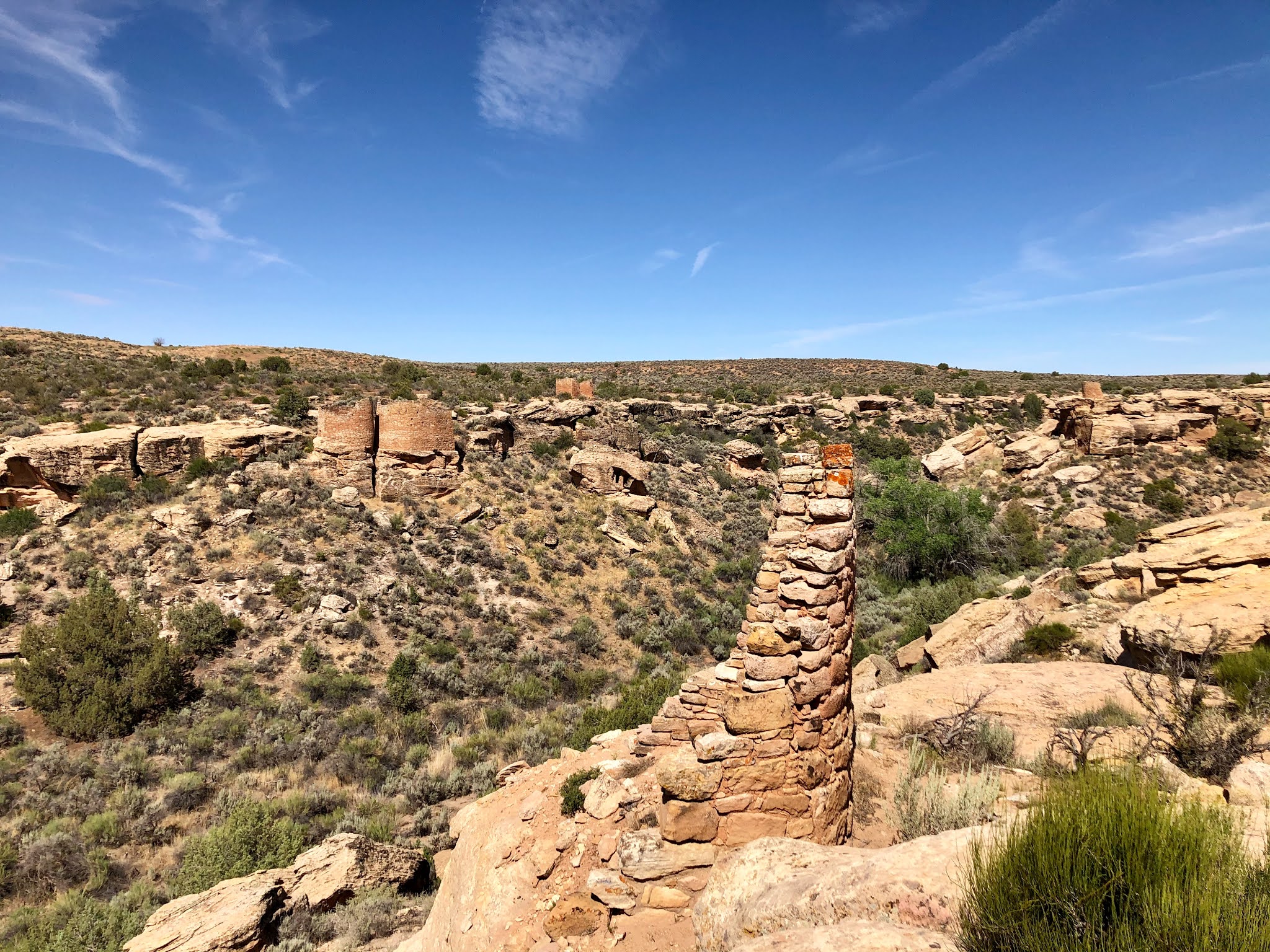
Just to the south of Tower Point sits Hovenweep Castle (the cover photo of this post) and Square Tower (the namesake of this portion of the park). The Castle likely had nothing to do with a fortress of any sort. I assume it picked up that name based on its resemblance to a medieval structure but it was likely not used either for defensive purposes or to house a ruler of sorts. It's big and has several surviving pieces to it, which makes for some incredible views.

Look down into the canyon after you pass Hovenweep Castle you'll spy Square Tower, which has been built with a twist or in a slight spiral. It's the only building on the site which shows this kind of a construction method and so is interesting just for that reason alone. While the intent behind the spiral is unknown of course, it certainly might add some strength to the couple of stories high building. It's interesting to see that people were experimenting with this type of construction. It's also pretty interesting that it's the only structure built this way. Maybe it didn't catch on or something.

Square Tower (in Little Ruin Canyon) with Hovenweep House beyond.
But the crown jewel on the Little Ruin Trail is for sure the Twin Towers. These two sizable buildings are built super close to one another and the walls of the two structures that almost touch are built using gentle curves, which had to have ramped up the level of difficulty. They probably had to have been built simultaneously to get their walls this close and as plumb as they are.

Get closer up to these two and you'll be more impressed. I imagine most of the buildings constructed of the vintage of those at Hovenweep were laid stone upon mortar (which is probably just dried mud maybe?) followed by more stones and more mortar and on and on. The builders of the Twin Towers took their craft a step further by using small spacer rocks in between the larger stone pieces so that the joints have a uniform thickness to them. It must have taken a lot longer to build this way because you need to find or craft two or three spacer rocks between every layer instead of just slopping a coating of mud to a close enough thickness.

The trail guide we used to walk the site described the Twin Towers as "among the most carefully constructed buildings in the entire Southwest." When the work that you have done is described in these sorts of terms over an entire region of a continent, I think you've done a pretty good job. Can you imagine how the builders of these two structures (or any of those still around for that matter) would feel knowing that 800 or 900 years later what they poured their heart and soul and sum total of building skill into is still standing? And without really any preservation for the vast majority of that time. I'd say job well done here. The original wooden lintel over what I assume is the door is also still intact. I'd be pretty pleased with myself if I built something and it was still around in the year 2700 or so. This is some pretty crazy stuff!

The Twin Towers.
Check out the spacer blocks between the rows on masonry in the Twin Towers wall.
I loved our couple of hours at Hovenweep. I think one of the things I liked the best was that the experience is small enough that you can cover everything including examining the whole site in detail and still do it all in a part of a day. You can almost get a sense of what life might be like on a day in the late 1200s as people worked hard at tending crops of beans, squash and corn in what I can only assume was a much more fertile valley than it was when we were there.

In many ways this was like the trip we took to Herculaneum near Mount Vesuvius in Italy. That place was so full of detail and information but still small enough that you could take it in given just part of a day. I'm not really equating Hovenweep to Herculaneum; they are completely different experiences. But Hovenweep was completely understandable pretty quickly. We didn't have to leave thinking we needed to go back because we didn't get everything we wanted out of a visit. Sometimes there's a lot of value to doing this. I certainly felt that way here.

We did not spend much time in the other units of the park. We drove out to the Horseshoe and Hackberry section to the east of Square Tower Group but decided based on our quick look out through the brush that we were probably not going to add substantially to our experience by making the hike out in the middle of the desert alone to those two ruins. I think we felt fulfilled enough by our time at Little Ruin Canyon.

It was also refreshing to see something manmade on this trip that meant something. I love spending time in nature but all nature and no human history can get a little repetitive, no matter how gorgeous and varied the landscapes we visited were. Maybe it's the architect in me that wants to spend just a little time around old buildings while traveling.

Climbing out of Little Ruin Canyon at the end of the hike.
So about that isolation. It's pretty out there. We got on the road early (figured we'd beat the crowds if there were actually any) and got to Hovenweep at about 10 a.m. We drove through the desert. We drove over gravel roads. We lost cell service. We followed signs that seemed contradictory to the maps we had. We made it.

The name Hovenweep means "deserted valley" in the Ute / Paiute language. That name works on a couple of levels. Little Ruin Valley was at one time deserted by the people who lived there and it's also pretty darned deserted today. We did find a couple of cars in the Visitor Center parking lot when we arrived. While out on the trail, we passed five people and a dog. That's it. Pretty isolated and easy to social distance. 

The wide open space and almost complete lack of other humans also let us take in a quiet sunny day in the American desert. Standing still at Hovenweep got us complete isolation in nature. There were crows cawing and maybe some flies buzzing and some noise in the vegetation if the wind kicked up a bit but other than that it was completely silent. If there were lizards scampering about (and there were) they added nothing to the sound of the desert. It's rare these days that I get to a spot where I get this kind of experience.

Another view of Hovenweep Castle.
Before we started our trek, we stopped at the closed Visitor Center to read a little about the place and its history. A few notes here. First, beware of rattlesnakes. Yikes! Isolation sounded good until you started talking about rattlesnakes. We didn't see any. We checked with four of the five people we passed to see if they saw any and they were all negative too.

We also found out what likely happened to the Puebloan people who called this place home all those centuries ago. Apparently there was some sort of prolonged drought sometime around the year 1270 which caused an exodus. Makes sense; you can't live without water. The people who make up the Hopi, Zuni and Rio Grande Pueblo tribes are thought to be the descendants of the settlers around the four corners that built the structures at Hovenweep and other sites nearby. 

Finally, just before you head out on the Little Ruin Canyon trail, there's a sign that recommends itineraries for those with limited time. I know you've probably seen signs like this before. You know..."If you have one hour..." or "If you have two hours..." Something like that. Only this sign starts out at 15 minutes. Who is going to go all the way out to this spot in the middle of the Utah desert to spend 15 minutes?!?!?! I don't see it. We ignored the sign and ventured forth. We did the whole thing. Don't go for 15 minutes. Do it all. Spend time looking and studying. Take it all in.

Fortunately...no!

How We Did It
Hovenweep National Monument is open every day of the year. Trails are open sunrise to sunset, which is pretty much all you need to know. Trail guides are available outside the Visitor Center.

We drove to Hovenweep from Moab south down US-191 and then took roads off that route to the east. As mentioned above, we lost cell service (and therefore Google Maps and other navigation aids) on the trip there. Keep an eye out for the signs if you do and follow them. It worked for us.

There are a couple of stops worth making on the way to or from Hovenweep. We stopped on the way there at Newspaper Rock, a giant petroglyph wall created by indigenous peoples and then added to / vandalized by later visiting Europeans. It's on the road to The Needles section of Canyonlands National Park. On the way back, we stopped at Needles Overlook, which gives you a terrific vista over most of the eastern part of Canyonlands. If you don't feel like driving to Hovenweep without seeing anything else, these two spots were worth it to us.

We drove back to Moab through Colorado. Given the fact that we weren't confident we could backtrack effectively and Waze said that was the way to go, we decided we'd give it a shot. If you do this, be prepared for lots of gravel roads which means plenty and plenty of slow driving. It got us home, but I'm not a fan of driving on gravel.

Thursday, July 23, 2020

Walking In Your Footsteps


Every so often we plan an activity or a series of activities on one of our trips that mostly or completely falls flat. This post is unfortunately about one of those times. Sorry.

What is it about dinosaurs that captures our imagination? Is is the size? The sheer variety of different animals that have been discovered? Is it the way they seemingly all disappeared at one time sort of mysteriously (although I thought I already solved that one before my 2017 trip to Mexico)? Is it something else? It's got to be because these things are utterly unlike anything we have on Earth today, right? Right? Who knows!

When I was a kid I loved dinosaurs. I guess I'm not unusual in that respect. Seems like every kid goes through some sort of phase like that. I remember my mom and dad taking me to London when I was growing up in England to see the diplodocus skeleton at the Natural History Museum. I don't remember actually seeing the skeleton (which it turns out was just a plaster cast) but I remember the significance of being taken to London just for that reason. My dinosaur fascination as a boy must have been important enough for my parents to venture to London with me and my sister.

Some kids grow out of their dinosaur phase. I'm not completely confident that I did. There's definitely a hold on me there. I wasted no time in 1993 going to the movies to see Jurassic Park and it remains one of my go to I'll-watch-anytime movies today. So when we were planning our Colorado and Utah getaway and I found out there were a number of accessible dino-themed sites, I was in. We had to add this stuff to our agenda.

Favorite dinosaur of all time, by the way...the ankylosaurus. My dad made me one from a kit and hand painted it when I was growing up. Always been my fav since then.

The corner of Stegosaurus Freeway and Brontosaurus Boulevard, Dinosaur, CO.
We had a plan. And it was a good one, I swear. If everything came together perfectly. 

After our time in Moab, we planned to head north in Utah to Dinosaur National Monument, which perhaps obviously is dinosaur themed. A little research about what there was to do on the way uncovered (pun intended) a couple of spots close to Moab where actual millennia-old dinosaur footprints can still be found. Plus we found an actual working dinosaur excavation going on around the town of Cleveland, Utah about two and a half hours to the north and west of where we were staying near Arches. Not exactly on the way but there isn't exactly a road leading directly north from Moab to Dinosaur National Monument either. You either have to go east through Colorado and then west back into Utah or go west and then east close to Cleveland. We figured we'd take the slightly longer way and take a chance on seeing a genuine fossil excavation before our very eyes.

All that and then seeing what there was to see at Dinosaur National Monument sounded like it added up to a pretty packed day or two of dino-sights.

Dinosaur was declared a National Monument in 1915 after the discovery of dinosaur bones there earlier in the century by paleontologist Earl Douglass. I guess the story here is that there were a significant number of dinosaurs in present day northeast Utah that died near a river's edge during a drought in the Jurassic period. Later on when the river was restored and ultimately flooded, it washed the skeletons of all the dead dinosaurs intact down to a localized area, essentially concentrating a great many bones into a very small area. When Douglass found the first fossils, he kept digging and found more and more and more, layer upon layer upon layer.

By the time Douglass was done at the site, he'd filled the halls of museums all over the United States and abroad, including at the Carnegie Museum in Pittsburgh (they funded Douglass' work), the American Museum of Natural History in New York and the Smithsonian in Washington, D.C. The quarry set up on the site produced more full skeletons than any other site in the world. This is significant stuff, folks. And they didn't even take all of the bones out of the place. 

A fragment of the Morrison Formation with the Quarry Exhibit Hall beyond.
Today the park that makes up Dinosaur National Monument spans between Utah and Colorado, although all the dinosaurs are in the Utah portion of the park. There are a ton of trails all over both sides of the park including something called the Fossil Discovery Trail that leads to the showpiece of the place: the Quarry Exhibit Hall, a building built around a massive piece of rock with over 1,500 unexcavated fossils visible.

Sounds awesome, right? It did to us. In fact, it still does to us. We'd love to visit there one day. We knew pretty much for certain that the Hall would be closed when we visited. I mean nothing else indoors and tourist-y not privately owned was open anywhere we went in Utah. So on Thursday, June 25, 2020 we missed out on the Quarry Exhibit Hall as we expected we would. But we were surprised by how closely we missed it. If we'd have been there one week later, we'd have been in. The Hall opened the following Tuesday. Oh well, at least we still had a working quarry, two sets of dinosaur tracks and the Fossil Discovery Trail at Dinosaur National Monument.

Not so much. I know I've whined more than my fair share about the heat on this trip and how it kept us from doing some things we wanted to do. This is the last time I will do this, I promise but...it was just too hot to make it to one of the sets of tracks. High 90s combined with very unsure and incomplete signage on Bureau of Land Management property made us give up the ghost at the Mill Canyon Dinosaur Trail. We also missed out on the Cleveland-Lloyd Dinosaur Quarry that we had planned along our route from Maob to Dinosaur National Monument. We needed it open Wednesday. It's not. Need to be there Thursday through Sunday to visit. We didn't know that when we planned the trip because 2020 hours hadn't been published yet.

Stegosaurus outside the Dinosaur National Monument Quarry Visitor Center.
After all that we ended up with the Fossil Discovery Trail and one dinosaur footprints site. Let's make the most of this thing!!!!

There is a point in the movie Jurassic Park where Jeff Goldblum's character, Dr. Ian Malcolm, while on the pilot ride through the Park and having seen zero dinosaurs, asks the Park's creator, John Hammond: "Now eventually you might have dinosaurs on your dinosaur tour, right?" 

I know I've plugged this movie as a classic in this post already but let me say that there are a few extremely teachable and relevant-to-everyday-life quotes in this movie, all of which seem to come from Ian Malcolm's mouth. The obvious one here is "life finds a way" but there's also "your scientists were so preoccupied with whether or not they could that they didn't stop to think if they should." I use variants of that last one all the time, mostly related to architects who want to try something they think is new. The book is even better than the movie. Enough plugging. Back to our hike along Fossil Discovery Trail, not that I was necessarily talking about that yet.

I related all that information because there was a point along Fossil Discovery Trail that I exclaimed in the hot morning Utah sun (straight in our faces again like at Delicate Arch in Arches) "now eventually they might have fossils on this fossil discovery trail, right?" About a half mile into the 1.2 mile trail (one way) we hadn't seen a darned thing. No fossils, no signs for fossils, heck, not even any signs for non-fossils. We did pass a couple of petroglyphs but no hint that we were on a fossil trail. Were we even?

View from a spot probably in the middle third of the Fossil Discovery Trail.
Eventually, we did find some signs, if maybe not some actual fossils. We stopped in front of a rock outcrop that was described as fossil-containing. Fish scales apparently. We had to look for the gold circles of unknown size, or at least unadvertised size based on the signage near the alleged fossils. We couldn't find any. We looked. Hard. Nothing. Move on.

There were two other spots along the Trail that contained fossil signage. One at a dead end which noted the presence of clams (again nothing) and one next to a giant tilted wall of stone which read, in part, "The Fossil Discovery Trail passes through several layers of tilted rock in which a variety of fossils are easily visible." 

Easily? Really? I know I don't have the best eyesight in the world but finding fossils on this massive stone face was not easy by any stretch of the imagination. We looked at this thing from every angle we could. We looked at it coming and going. We climbed the stairs that run the length of the wall (twice) and stopped a different points on the way up and the way down and scanned every square inch we could. We found one and that was only because it was next to a painted white arrow pointing right at it. Maybe some sort of spine. 

If it wasn't for the arrow, we likely wouldn't have spotted what we saw. We were informed (again by the very helpful signs) that the larger bones are marked by white arrows. Despite that giveaway, we could only spot one fragment of dinosaur, probably because we could only find one white arrow.

The Fossil Discovery Trail is typically a 1.2 mile walk, because one leg of the walk is usually taken on the shuttle bus that takes you from the Visitor Center to the Quarry Exhibit Hall or vice versa. We walked the Trail both ways because obviously no shuttle buses run when the Hall is closed. I like treasure hunts. I also like finding treasure. Treasure hunts with no treasure are not so much fun.

See the fossilized fish scales? No? Neither did we.
Finally a dinosaur fragment. The white arrow helped a ton.
Every so often we come across something in our travels that seems pretty pedestrian (I know...I'm killing it with the puns on this one) but which afterward with the benefit of thought and reflection blows me away. Surprised I'm writing that about one fossil found on a trail with "easily" found fossils? That's because I'm not. I'm talking about the one dinosaur tracks site we made it to on our trip to Moab to Dinosaur the prior day. Yes, we turned away at the Mill Canyon Dinosaur Tracks site (or technically before we got there). But we didn't give up at Copper Ridge.

The Copper Ridge Dinosaur Tracks are located about two miles off US-191 just north of Moab. The road that takes you there is a dirt and gravel surface and despite the short length it will take you between 5 and 10 minutes to eventually get to a small parking area with a notice board of sorts. Head up the hill about 200 yards on what looks like it's probably a path and you'll come to two areas that look like dried mud with some depressions or marks in the surface and a couple of silver signs. You've reached your destination.

The tracks at Copper Ridge are the same sort of vintage as the fossils that Earl Douglass found (but we didn't) at Dinosaur National Monument. That is Jurassic period about 150 million years ago. They actually come from the same layer of stuff in the Earth on a vast plain that covers parts of several present day states called the Morrison Formation. 

Sauropod tracks!!!
What you will find at the top of the short trail at Copper Ridge is two sets of footprints: one from a four legged herbivorous dinosaur (think long neck and long tail) or sauropod and one from a carnivorous or meat-eating dinosaur that walked upright on two legs (think tyrannosaurus rex although this one was not a t-rex, nor was it that size). Honestly, if I were on a hike not looking for these things, I probably would have walked right past them. Heck, if there weren't signs there and I was looking for them, I'd probably walk right past them.

On one level, these things are quite unremarkable. I guess it's cool to walk alongside where a dinosaur once walked doing nothing special. It's interesting to see how big their strides were as you step near the tracks made so long ago. This works better with the sauropod tracks since the steps are deeper and more numerous; while the signs told us there were more than one carnivore tracks, it also said the tracks are frequently filled with dust and may not be visible. We saw one. After five minutes or so at both sites, we were about done.

After we left, though, I realized something truly amazing and that's simply that these things are even here any more. I mean, it's not like the dinosaurs that made these tracks walked by where we stood last week or last year or even last century. We are talking 150 million years here. And they are still there for me to walk by and look at for five minutes. It's also not like they have been protected and preserved all this time. Or really any time at all. There aren't even any barriers preventing clueless tourists from just walking right over them today. They are just in the middle of the Utah desert for anyone to stumble upon. Think about how many times something could have potentially wiped these things off the face of the Earth the last 150 million times our rock rotated around the sun. No earthquakes, no floods, no thieves, no mudslides, no rocks falling, not even another dinosaur coming by the very next day and wiping their prints away. Nothing for a long, long, long time has disturbed what two dinosaurs made just by walking through something soft enough to leave an impression. How amazing is that? These things are the ultimate survivors.

I don't feel like I missed out on anything here by leaving after five minutes, but I think the more time I spend away from our trip, the more I appreciate the good fortune through an enormous amount of years that allowed me to see what I saw on that hill up on Copper Ridge. I feel like we took in something really consequential, even though it probably wasn't anywhere near that in the lives of two extinct creatures.

Carnivore footprints!!!
We had great intentions for this portion of our trip. Dinosaur National Monument was supposed to be the highlight for us and we were done in by some extremely unfortunate timing. It would have brought somewhat of a full circle to my life's dinosaur experience to see something incredible at that site because the diplodocus that my parents took me to see all those years ago in London likely came from that very same place (it was donated by Andrew Carnegie after being discovered in 1905 in the United States).

While this ended up falling far short of my best dino-tour ever (!!) that I had planned. We still had a few memorable experiences. I won't forget those tracks any time soon.

We also got some great looks at all sorts of dinosaur statues in varying shades of realism, including the pretty realistic stegosaurus shown above (apparently produced for the 1964-65 New York World's Fair) and the not-so-realistic-but-oh-so-fun pink dinosaur built in 1958 to advertise the now demolished Dine-A-Ville Motel in Vernal, Utah. We also found a number of wholly unlifelike and very small dinosaurs in the town of Dinosaur, Colorado just before we drove by a dispensary with some sort of primitive and likely stoned metal dinosaur sculpture out front.

On top of all that, we got up close and personal with the Green River that we'd seen from a distance in Canyonlands National Park earlier in the week. 

Best dinosaur tour ever? Not so much. Worth it? Completely. Sometimes you don't find what you hope for when you travel. If there was a day we could have cut out and missed very little, it would have been our day in Dinosaur National Monument. But we didn't know that then and what else were we going to do? We were in the middle of the desert. Hike some more in Canyonlands? Not in that heat. No regrets here. Besides, the best of this trip was yet to come when we passed back into Colorado.

We had to stop at the Sinclair for gas on this trip. HAD TO!!!

How We Did It
The Utah side of Dinosaur National Monument is open almost every day of the year. The Quarry Visitor Center is open most days from 9 a.m. to 5 p.m. and the Quarry Exhibit Hall is open most of those same days from 9 a.m. to 4:30 p.m. or maybe even later. That is when there's not a global pandemic in full force causing stuff to close in Utah. Check their website for hours before you go. And I hope when you go that the Quarry Exhibit Hall is open. While we didn't have a whole lot of success on the Fossil Discovery Trail, I'd recommend a one way trip anyway. Maybe your eyes are better at spotting white arrows on a rock wall than ours are.

The Copper Ridge Dinosaur Tracks and the Mill Canyon Dinosaur Tracks are both on land owned and maintained by the Bureau of Land Management, meaning it's pretty much just unregulated desert wilderness. The tracks themselves at Copper Ridge are pretty accessible and easy to find. Just park near the sign and hike up the hill. When you get to the top of the hill, the tracks are visible on the right. As mentioned above, we turned back at Mill Canyon not knowing how much longer we would have to walk to find what we wanted. I hope you have better luck. Click the name of each site in this paragraph to visit the BLM's site with some rudimentary descriptions and maps. Good luck!

The Cleveland-Lloyd Dinosaur Quarry is located at Jurassic National Monument which is another spot administered by the Bureau of Land Management. 2020 visitor hours are Thursday through Sunday 10 a.m to 5 p.m. April 2 through October 31. I'd love to be able to tell you it was amazing or really anything about this place but as you know we never made it. Visit the BLM's sites for the Quarry and the Monument by clicking the links earlier in this paragraph.

Finally, follow in our footsteps on this trip and I'm sure you'll see all sorts of dinosaur sculptures. Take pictures and have fun.

Thursday, July 16, 2020

Two Rivers


We started our trip to Colorado and Utah last month by flying into Denver International Airport. After hunkering down in the mile high city for a night, we got up the next morning and headed west along I-70 towards Utah. When we got to Dotsero, Colorado, we found ourselves driving alongside the mighty Colorado River for about 100 miles until our path diverged at Grand Junction. Following that waterway down Glenwood Canyon was one of the two or three driving highlights of this trip. Yeah, I know that's a lot of driving highlights, but riding alongside that river was awesome.

After Grand Junction, we weren't separated from the River for long. We'd meet up with a wider version of the Colorado later that same day just before pulling into Moab. And later on in the week, we'd be searching for wildlife close to the River's source in Rocky Mountain National Park. In many ways, our journey was guided by the Colorado. We even walked over it on our stop to find Doc Holliday's grave.

Between our drive on I-70 and our time in Rocky Mountain National Park, we came across another of the west's great rivers: the Green River. The Green parallels the Oregon Trail in Nebraska and caused many a westward pioneer to lose their wagons, mules and even their lives on the way from the Missouri River to the Oregon Territory. Our encounters with the Green were much less treacherous. We stopped at a few viewpoints to watch the river flow just after its crossing into northeast Utah. 

The Green meets up with the Colorado just south of Moab in Canyonlands National Park, the second of the three great National Parks we went to Colorado and Utah to visit. Our visit to that Park is what this post is about.

Grand View Point Overlook. Island In The Sky. 
By the time we got to Canyonlands, we had already been to Arches and already understood a little bit about the sheer size of the red-orange-amber-brown rock wonderland that makes up that Park. And it is big, covering about 120 square miles (for perspective, Rhode Island is just a little bigger than 1,200 square miles). That was way more than we could have realistically covered in a few days, let alone the few partial days we spent there.

Canyonlands is about four and half times as big as Arches, a massive 525 plus square miles. We reserved one day to explore. There's no way we were covering the whole thing in a single day. Triage time!

Canyonlands is essentially a massive plateau broken up into three parts by the two rivers that meet in about the center of the park. The two rivers form essentially a huge "Y" with the Green on the left side of the letter, the Colorado on the right and the combined flow (the Colorado again) on the bottom. Each of the three parts of the Park are separate and distinct and you cannot travel from one part to a different part without venturing right down to one of the rivers and crossing it somehow. And that's not an easy proposition.

There's actually a fourth part of Canyonlands to the west of the main park called Horseshoe Canyon. Compared to the other three sections of the Park, it's tiny, but apparently it contains some incredible petroglyphs. We didn't go. You'll see why in a paragraph or two.

Six Shooter Peaks. Wingate Sandstone. On the road to The Needles.
The plan for our one day at Canyonlands was to visit Island In The Sky, the northern part of the Park between the Green and the Colorado, and then move on to The Needles, defined by the Colorado before and after the confluence with the Green. It would take us about 40 minutes or so from our base in Moab to reach the Island In The Sky Visitor Center. After exploring that part of the Park, our drive time to The Needles Visitor Center was two hours. That was by far the closest drive between two sections of the Park. It would have taken about another 40 minutes at least to get to Horseshoe Canyon. Island In The Sky to The Maze (in the southwest of the Park) was a six hour drive. 

Two hours sounded just fine.

We knew the day we were at Canyonlands was going to be a scorcher. If I'm remembering right, this was the day the temperature hit 100 at about noon. And there is no shade whatsoever in the Park. I decided I'd claim some measure of success if we could get a good look at both rivers. That became my goal for the day.

First stop: Island In The Sky Visitor Center for some rangerly advice. Where can we see the rivers? His advice was not encouraging. Maybe from Grand View Point Overlook (a two mile roundtrip hike) or Murphy Point (a 3.6 mile roundtrip hike). Probably from Green River Overlook. 

Probably? Why call a spot in the Park Green River Overlook if you can't look out over the Green River? I was not super encouraged.


So here's the thing about seeing the rivers. The ground you walk on in Island In The Sky at Canyonlands is essentially flat. Walk to the edge of that section of the Park and you'll find another flat plain maybe 1,000 feet below you or so (I'm guessing on this distance)  That's not where the rivers are. The rivers have carved canyons further below, a full 2,000 feet from where you are standing (not guessing so much on that number). And the canyons are pretty narrow, all things considered, which doesn't really let you get a good angle to look down into them. Your view ends up being something like the photograph above. There's a canyon there for sure. And there's probably definitely a river at the bottom. You just can't see it. You need to get to the right viewing angle. And it's difficult to get to that without descending further down, which is about impossible to do without an off-road vehicle and some serious free time. We had a four-wheel drive SUV, but not near enough time.

We did spend our time doing a little walking. And I do really mean a little. We planned on three stops: Grand View Point Overlook as recommended by our ranger friend; Green River Overlook in hopes that you could actually see the Green River from the eponymous spot; and a quick hike to Mesa Arch, because somehow we felt we didn't see enough arches on this trip.

Grand View Point Overlook was scenic. No doubt. There were no rivers to be seen but you are literally (if you choose to do so) walking along a cliff edge that plunges hundreds of feet down to an arid but absolutely gorgeous canyon. Amazing stuff. No guardrail or nothing. Just an unrestrained view of some amazing nature. Done with that one. Onto Green River Overlook.

Can you actually see the Green River from the Green River Overlook. OF COURSE YOU CAN!!!  That's why it's called that. Green. River. Overlook. Not the best view of a river I've ever seen and also not the best view of the Green River I'd get on this trip. But we saw it. One river down. One to go.

We didn't have the same luck with the Colorado River in Island In The Sky. Didn't see it. We left Colorado-less. On to The Needles. We had pretty much no shot at the Colorado there. We knew it and went anyway. Two hours to Needles. On the road again.

Oh...and Mesa Arch? Closed. I didn't really need any more arches on this trip anyway. I was good.

I know a lot of these pics look the same but the Green River is in this one. Right of pretty much dead center.
The rock that makes up the landscape you drive through in Canyonlands was deposited in that spot on Earth over millions and millions of years. The top surface of Island In The Sky was soil carried by wind and water from about 180 million years ago. Drive down to The Needles and you'll find yourself cruising through an environment much lower in elevation and much older. Like maybe 80 or so million years older.

We ended up spending all of about an hour or so in The Needles. The star attraction in this section of the Park is a rock formation know as (surprise! surprise!) The Needles. The formation itself is a series of sandstone spires fractured by the action of that layer of rock sliding over an underlayer of salt and then being eroded by rain, ice and snow into a series of multicolored towers of rock. The photos in the Park brochures look amazing. We couldn't get close enough on a day with a lot of heat haze to get a great picture to match the glossy pics in the free maps you can pick up at the Visitor Center. This despite an off road trip down to Elephant Hill.

Pro tip on this one: you can't actually see The Needles from Elephant Hill, and you can't go any further than that spot without a permit to drive a four wheel drive vehicle. So if all you want to see is The Needles, don't drive all the way down that track. There's a decent view of The Needles maybe about halfway there with some signage. I'd turn back after this spot if you don't plan on hiking anywhere. With temperatures the way they were when we were there, we passed on the hiking.

A hazy view of The Needles. Best we'd get on our day.
It may seem a little crazy to drive two hours each way to a place to only spend about an hour in the actual place you've driven to. But I believe there's some saying about the journey sometimes being better than the destination. The Needles was that for me.

The approach to this section of the Park is a drive over some of the most gorgeous canyon land I've ever been through. It's like you are driving along a pretty wide plateau along the edge of towering cliffs on your right with distant rock formations far away on your left, including two amazing chimney rock formations known as the Six Shooter Peaks. It's probably like that because that's exactly what you are doing. Having just come from Island In The Sky, you can get a great perspective on how far down you are towards the rivers and that what you are driving below is the same sort of elevation you'd been walking on just a few hours before.

The cliffs you drive by are impressive. It's almost as if someone has placed some sheer hunks of rock on top of some massive sand piles made up of some loose rocks (like as big as car-sized) with some smaller ones filling in the gaps. Of course, it's nothing of the sort. The sand piles are actually made up of rock that has split off from the main cliffs and tumbled down towards the very road you are driving on. Concerned? You might need to be. There are massive (did I say car-sized? maybe it's really small house-sized) rocks on the other side of the road from the cliffs that have clearly rolled to their current positions. Don't want to get caught up in that.

Driving to The Needles. Those rock on the left of the road came from the right side I'm pretty sure.
There is some pretty impressive geology to see in the Park itself after that awe-inspiring drive too. I was amazed by the layers you can see in The Needles section. Maybe you can't get so close to the needles themselves, but there are plenty of other mushroom-shaped rock formations with red-brown bases and sandy white tops. The top-most pale layer sticks out in a striking fashion against the darker stems. We didn't see this sort of layering at either Island In The Sky or at Arches because that kind of rock is hundreds of feet below where you are walking. Go to The Needles for this stuff.

And the River? Nope, we didn't see the Colorado here either.

Now, there is a spot in this section of Canyonlands where you can clearly see both rivers. It's called Confluence Overlook and it's right on top of the location where the Colorado merges and swallows the Green. This is exactly where I wanted to be. However, it's also a five mile hike from the nearest parking lot or a one mile hike from the closest vehicle-accessible off-road permit-required trail. Caution being the better part of valor definitely kept me from Confluence Overlook. No way was I hiking five miles (that's each way by the way) in three-figures heat with no shade. Nor was I choosing a completely isolated spot in southeast Utah to test our rented Chevy Equinox on some sand trails. No thanks. Better safe than sorry.

Island In The Sky. No Colorado. The Needles. No Colorado. This river runs right through like the whole Park and we couldn't see it at all. Not one glimpse. Not one drop. Nothing.

Big Spring Canyon Overlook. The Needles. Canyonlands National Park.
But we did see the Colorado.

Right outside the entrance to Island In The Sky, there's a place called Dead Horse Point State Park. Odd name, I know. Apparently the point of land that forms the park was perfect for capturing wild horses. The legend is the cowboys who corralled the horses took the ones they wanted and left the others to die of exposure after being captured. Thus...Dead Horse Point. A bit macabre I guess. But that's not the point really.

Dead Horse Point State Park is to the east of Canyonlands or in the upstream direction of the Colorado River. And the River runs right by the point that gave the Park its name. And by right by I mean like it's right there below you. You can see it snaking back and forth through the canyon 2,000 feet below you and the view is magnificent. There aren't a lot of trips that I've taken where I've admired a river in nature but we really got to do it in Colorado and Utah. And the view of the Colorado working its way across the canyons of Utah from up high was the best we got. It looks so lazy and slow but it's what carved most of the landscape that we ended up seeing in Canyonlands. The power of water and the silt and sand it carries over millennia is incredible. This is a body of water worthy of respect. I got that from Dead Horse Point. This park saved us. It saved the whole day. I wouldn't have been the same without this visit.

The Colorado River, as seen from Dead Horse Point State Park.
In my opening post about this trip, I wrote that circumstances conspired against us in taking full advantage of one of the Parks we visited. Canyonlands was that Park. Too hot. Too big. Did that mean we didn't get a lot out of our day there? Absolutely not. But I didn't get the same satisfaction I got out of Arches. The level of intimacy was missing, which is understandable given the vastness of the place we found ourselves in. You can't always get what you want in life or when you travel. This was one of those times.

Karma made up for it later in the week. And I wouldn't have traded what we found a few days later for anything. And I also wouldn't have missed our stop at Dead Horse Point for anything. Go here to see the Colorado. Maybe one day I'll get to Confluence Overlook. But honestly, probably not.


How We Did It
Canyonlands National Park is open 24 hours per day, seven days a week, 365 (or 366) days per year. It's vast. Like really vast. There are so many things to do there which take a ton of time. If I were a more adventurous and patient traveler, I'd spend a few days here hiking and taking it all in and finally making it to see both rivers up close. 

Speaking of rivers, the Park's website does have a list of river excursion operators. If it weren't for this whole deadly virus thing, I would really have loved to have consider a non-whitewater float on either the Green or the Colorado. But spending any time in a boat with a bunch of strangers? Not interested this year.

Dead Horse Point State Park, which I considered the highlight of my day at Canyonlands (if that wasn't obvious) is also open every day of the year. Their website lists their hours as 6 a.m. to 10 p.m. daily although they have campgrounds so clearly you can stay overnight. We opted not to camp because we've never ever camped and it will take something pretty extreme to make me ever camp. 

Finally, if you want as close to a bird's eye look at Canyonlands that you can get while on the ground, or just want to get a different view of how massive the Park is, I'd suggest a stop at Needles Overlook, a park owned by the Bureau of Land Management out in the middle of nowhere. There are several overlooks to the Colorado River valley (although we failed to see the River from this spot just like we did in the actual Park) and The Needles. To get there, head south out of Moab on US-191 and hang a right on Needles Overlook Road. Or just plug it into your favorite directions app. Once you make the turn off 191 you can't miss it.